The source
Where does Düden’s water come from?
The water you see at the waterfall is not born there. It rises at springs north of Antalya, travels kilometres underground and breaks the surface again in Kepez. This page follows that journey end to end: where it sinks, how far it goes and where it comes back.
Six stops from spring to sea
- 01
Kırkgöz and Pınarbaşı
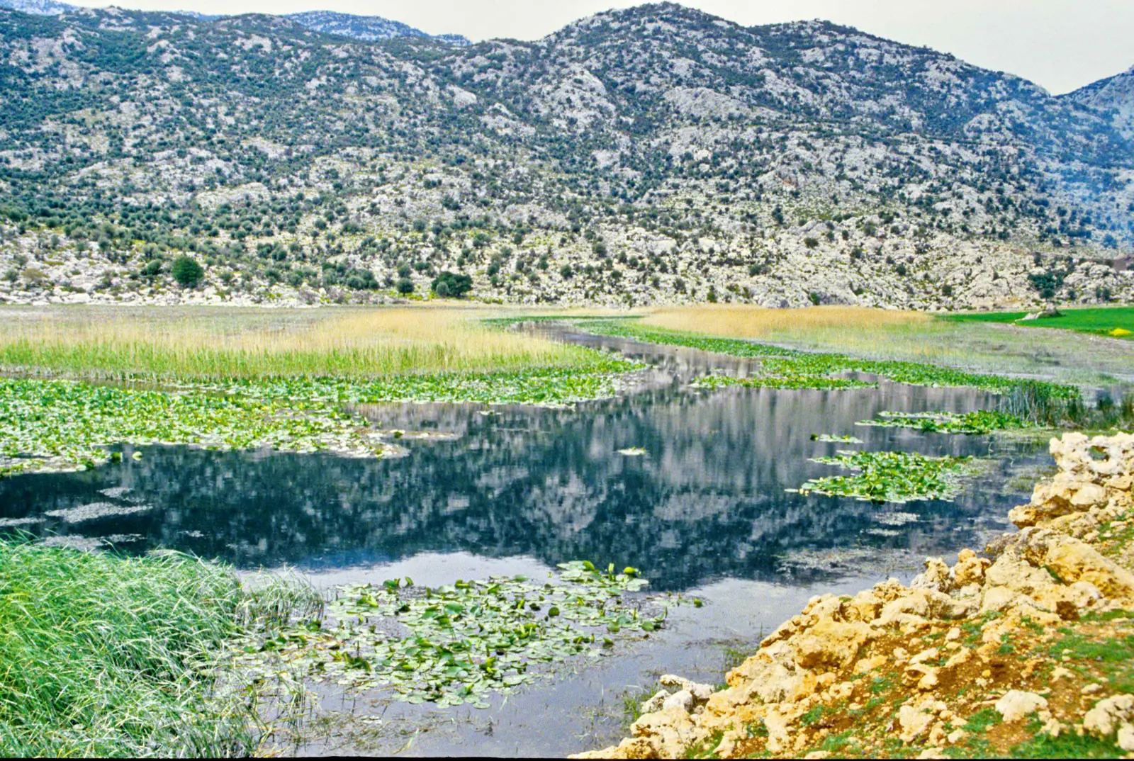
DöşemealtıThe water leaves the ground at karst springs north of Antalya. Kırkgöz and Pınarbaşı are among the largest springs in the region, fed by an underground network that rainwater has cut through limestone over thousands of years.
- 02
Bıyıklı sinkhole
Kömürcüler, DökülgenThe two springs join, run about 2.5 kilometres on the surface, then drop 7.5 metres into a siphon at Dökülgen. This is the Bıyıklı sinkhole, and at 17 kilometres it counts among the longest in Turkey.
- 03
The kilometres in the dark
UndergroundFrom here nothing is visible. The water moves through galleries inside the limestone. According to Wikipedia, the water surfacing at Upper Düden is the water that vanished 18 kilometres away at Bıyıklı.
- 04
Düdenbaşı
KepezThis is where daylight returns. The name says it: Düdenbaşı means the head of the sinkhole. This spring feeds the basin of Upper Düden Waterfall.
- 05
Through the city
Kepez to MuratpaşaFrom here the Düden river runs on the surface and crosses Antalya. It is the only ordinary-looking stretch of the journey, though the bed carrying it is the same limestone.
- 06
The cliffs and the sea
Towards LaraThe journey ends at Lower Düden. The water falls 40 metres off the cliff edge into the Mediterranean. It reaches the sea without touching land, which is why it reads best from the water.
A düden is a landform, not a waterfall
In Turkish a düden is the natural hollow where a river sinks underground. So the name of the Düden Waterfall comes not from the fall itself but from the place where the water disappears. That is why you also hear names like Bıyıklı Düdeni and Varsak Düdeni: they are all points where the same water goes under.
This kind of country is built of limestone, and rain dissolves the rock over centuries until galleries open inside it. The ground beneath Antalya is full of such a network. The waterfall is the one visible end of it.
5,280 metres a day
The underground route is measured rather than assumed. Dye was introduced at the Bıyıklı sinkhole and watched for at Düdenbaşı, giving an average groundwater velocity of 5,280 metres per day. In karst country water does not seep through a porous bed; it runs through open galleries. That is why it moves this fast.
There is a visitor-facing side to this too: pollution entering the spring area travels fast enough to reach the waterfall within days.
The curtain you see at Upper Düden
This part deserves plain speaking. Düdenbaşı is a genuine karst spring and the water does come out of the ground there. But Wikipedia records that the water forming the waterfall is brought through a canal from the Kepez 1 hydroelectric power plant and drops into the basin of the spring.
So what you are looking at is the work of both nature and people. There is no point hiding that, and it is more interesting to look at knowingly. It is also one reason the flow changes with the season.
Frequently asked questions
Where does the water of the Düden Waterfall come from?
From the Kırkgöz and Pınarbaşı karst springs north of Antalya. After a short run on the surface the water sinks at the Bıyıklı sinkhole, travels through limestone and surfaces again at Düdenbaşı in Kepez. The waterfalls form after that.
How far does the water travel underground?
Wikipedia states that the water surfacing at Upper Düden disappeared 18 kilometres away at the Bıyıklı sinkhole. The Antalya cultural inventory gives the length of the Bıyıklı sinkhole as 17 kilometres. Both describe the same order of magnitude and we report each as given.
How fast does the underground water move?
It has been measured. A dye tracing test between the Bıyıklı sinkhole and the Düdenbaşı spring gave an average groundwater velocity of 5,280 metres per day (Hoffmann et al., 2025). That is fast for karst.
Is the water I see at Upper Düden the spring water?
Not all of it. Wikipedia notes that the water forming the waterfall arrives through a canal from the Kepez 1 hydroelectric power plant and drops into the basin of the spring. The curtain you see and the karst spring meet at the same point.
Are Upper and Lower Düden different water?
No, it is the same water. The Düden river makes its first waterfall in Kepez, crosses the city and then falls from the eastern cliffs into the sea. They are the start and the end of one journey.
The two visible ends of the journey
Knowing where the water comes from changes how the two waterfalls read. Upper Düden is where the journey surfaces, Lower Düden is where it ends.
Last reviewed: 2 August 2026
Sources: Düden Waterfalls, Wikipedia · Bıyıklı Düdeni, Antalya Cultural Inventory · Hoffmann et al., Journal of Hydrology: Regional Studies 57, 2025
